Subject: Southern China
Period: 1737 (circa)
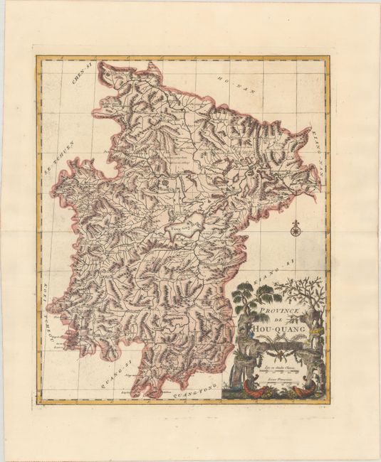
Publication: Nouvel Atlas de la Chine, de la Tartarie Chinoise, et du Thibet
Color: Hand Color
Size:
16.1 x 19.2 inches
40.9 x 48.8 cm
A fine detailed map of the province of Hunan in south central China. The map is approximately centered on the Dongting Lake, flood basin of the famous Yangtze River. Attractive title and scale of miles cartouche compliments the detailed map. D'Anville assembled maps of China compiled from an extensive Jesuit survey carried out in 1708-16 for the Emperor Kang-Shi, which were published in Jean Baptiste du Halde's Description Geographique Historique... de l'Empire de la Chine et de la Tartarie Chinoise in 1735. It remained the principal cartographical authority on China during the rest of the 18th century. The missionaries used local sources and personal observation to prepare these incredibly detailed maps. The maps were then re-engraved by D'Anville for a Dutch market two years later and published in an atlas volume, Nouvel Atlas de la Chine, de la Tartarie Chinoise, et du Thibet.
References: Shirley (BL Atlases) T.HALD-3a #8.
Condition: A
A dark impression on a bright sheet with the watermarks of "Honig" and a fleur-de-lis coat of arms, and light printer's ink residue.