Subject: Central China, Henan
Period: 1655 (published)
Publication: Novus Atlas Sinensis
Color: Hand Color
Size:
19.5 x 15.9 inches
49.5 x 40.4 cm
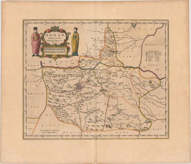
This map of the Henan province is centered on the Yellow River, Crocei F. Pars, from which Henan derives its name. A legend at right illustrates towns of various sizes, forts, and the locations of gold, silver, and tin mines. The cities of Caifung (Kaifeng), Honan (Zhengzhou), and Nanyang are well depicted. A strapwork title cartouche incorporates the scale of miles and is flanked by a man and woman depicting the native dress of the region. Blank verso.
The second landmark in the European mapping of China was the appearance of the Novus Atlas Sinensis in 1655. It was compiled by Father Martino Martini, an Italian Jesuit, and produced by the most prominent Dutch cartographer of the time, Johannes Blaeu. Father Martini compiled the work based on Chinese sources between 1643 and 1650, and it greatly advanced European knowledge of the region including the astronomical positions of many cities and topographical features. It remained the standard geographical work on that country until the publication in 1737 of D'Anville's Atlas de la Chine.
References: Van der Krogt (Vol. II) #8425:2.
Condition: B+
A nice impression on watermarked paper with contemporary outline color and later color in the cartouche. There is light toning and faint offsetting.