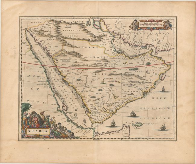
Subject: Arabia
Period: 1663 (published)
Publication: Le Grand Atlas
Color: Hand Color
Size:
20.9 x 16.4 inches
53.1 x 41.7 cm
This elegantly engraved and uncommon map divides the Arabian Peninsula into the three regions coined by the Romans: Arabia Petraea, Arabia Deserta, and Arabia Felix. It was published in an era when European knowledge of the region was expanding thanks to increased trade with the Orient. The coastlines are fairly well represented and the interior contains details of the navigable rivers; although this information and the locations of inland towns is largely speculative due to unreliable and often conflicting reports from merchants and explorers. Medina, Mecca, and Aden are among the notable cities identified. Decorative elements include a camel, sailing ships, and an ornate title cartouche featuring camels, putti, and figures in local dress. Tibbetts contends that this is the source for Jansson's similar map of 1658, despite having an apparently later publication date. French text on verso.
References: Ankary #65; Tibbetts #109; Van der Krogt (Vol. II) #8180:2.
Condition: B+
A crisp impression on watermarked paper with some light uneven toning and a small spot in an unengraved area at left.