Subject: Holy Land
Period: 1624 (published)
Publication: Theatri Orbis Terrarum Parergon
Color: Hand Color
Size:
17.8 x 13.4 inches
45.2 x 34 cm
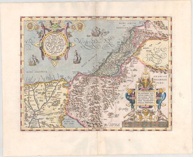
This is Ortelius' third map of the Holy Land. It covers the region from the Nile Delta to Lebanon, and focuses on the desert of the Exodus. Ortelius' map was based on Tilemanno Stella's map of 1557 that became the prototype for the modern cartography of the Holy Land. Stella adapted the coastline and Dead Sea from the configuration of Jacob Ziegler's map of 1532. But here, Ortelius rounds Stella's angular Dead Sea and the Gulf of Aqaba. The map is richly decorated with two elaborate, neoclassical cartouches. The sea is teaming with three ships (one of which is shown with canons firing). This example is from the third of three plates used for the Theatrum. Latin text on verso.
References: Nebenzahl (HL) pp. 84-86; Laor #539; Tooley (TMC-3) p. 28; Van den Broecke #172.
Condition: A
A crisp impression on a clean, bright sheet with several small worm holes along the centerfold that have been professionally repaired with a minor amount of the image replaced in facsimile.