Subject: Western Italy
Period: 1741 (published)
Publication: Description Exacte de l'Univers
Color: Hand Color
Size:
19.3 x 13.5 inches
49 x 34.3 cm
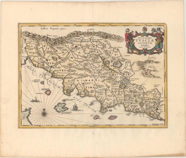
Pieter Van Den Keere (Petrus Kaerius) engraved this attractive map of ancient Tuscany. It is based on Ortelius’ map that was in turn based on Bellarmati's map supplemented by classical sources. The map is very detailed and includes the coastal islands. It locates the major Etruscan and Roman settlements and the Roman roads. The map is embellished with surveyors flanking the title cartouche, a compass rose, and sailing ships. Blank verso, published in Pieter de Hondt's Description Exacte de l'Univers, ou l'Ancienne Geographie Sacree et Profane, a French edition of Georgius Hornius' Accuratissima Orbis Antiqui Delineatio, which included maps from Johannes Jansson's historical atlas and Abraham Ortelius' Parergon.
References: Van der Krogt (Vol. I) #7200H:1.
Condition: A
A sharp impression on a bright sheet with wide margins, minor printer's ink residue at far left, and a couple of minor creases.