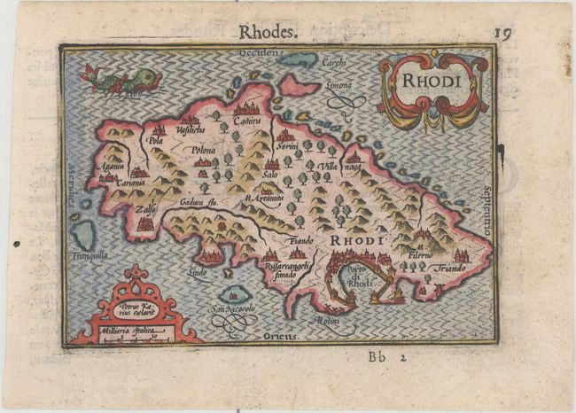
Subject: Rhodes, Greece
Period: 1600 (published)
Publication: Thresor de Chartes
Color: Hand Color
Size:
4.9 x 3.4 inches
12.4 x 8.6 cm
Charming map of the island of Rhodes, embellished with a moiré patterned sea, a sea monster, and strapwork title and distance scale cartouches. The land is fully engraved with mountains, forests and cities, and the famous fortified harbor is beautifully shown. Engraved by Pieter van den Keere (Petrus Kaerius). French text on verso.
The map was first published by Cornelius Claesz and printed by Barent Langenes in the 1598 edition of the popular Map-treasury. For the 1599 edition, graduation lines and latitude numerals were added to one side of the border on most of the maps, which were again used for multiple editions through 1650. This is the second state with the added graduation lines from a French edition, printed by Albert Hendricks.
References: King (2nd ed.) p. 80-82; Van der Krogt (Vol. III) #7955:341.
Condition: A
A dark impression with minor marginal soiling.