Subject: Western Hemisphere - America
Period: 1627 (circa)
Publication:
Color: Black & White
Size:
19.8 x 15 inches
50.3 x 38.1 cm
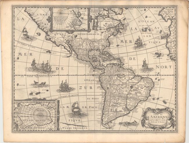
According to Burden, "this rare map is one of a set of the four known continents that Melchior Tavernier had engraved, with or without Petrus Bertius' permission is unclear." Burden attributes Cornelis Danckerts (the elder) as the engraver. The map itself bears only the name P. Bertius and while similar to his map of 1624, this map has a completed western coast of North America and different decorations in the sea. Both are based on Jodocus Hondius' map of 1618, with the completion of the southern coast of Tierra del Fuego. The map is richly embellished with two polar insets, a decorative cartouche and numerous ships, sea battles, sea monsters, and scenes of Native American life in South America. This is the first state without Neuf Amsterdam and other colonial place names in the Northeast and West.
References: Burden #218.
Condition: B+
A dark impression on watermarked paper with light offsetting and minor printer's ink residue.