Subject: Russia in Europe
Period: 1705 (published)
Publication: Algemeene Weereld-Beschryving…
Color: Black & White
Size:
9.6 x 7.5 inches
24.4 x 19.1 cm
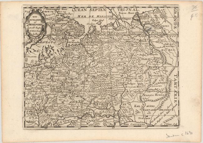
Attractive copper engraved map of European Russia showing its political divisions, major topographical features, cities and towns. The map extends to the Caspian Sea at bottom right, adjacent to which is the "Great Desert" or Desert de Karakath. It is embellished with a strapwork title cartouche and was engraved by Antoine de Winter.
This map appeared in Algemeene Weereld-Beschryving, nae de Rechte Verdeeling der Landschappen, Plaetsen, Zeeën, Rivieren, &c. Geographisch, Politisch, Historisch, Chronologisch en Genealogisch, a Dutch edition of A. Phérotée de la Croix's Nouvelle Methode Pour Apprendre Facilement la Geographie Universelle, which first appeared in 1690. The Dutch edition was published by Francois Halma and included 98 maps and views. Halma acquired many of the plates for Algemeene Weereld-Beschryving from Joannes Ribbius, who had enlisted the services of engraver Antoine de Winter to make copies of the maps in Nicolas Sanson's quarto atlases of the four continents. De Winter made very few geographical changes and maintained the attribution to Sanson on the newly engraved plates. Halma supplemented the Sanson maps with about a dozen new maps engraved in the same style as Sanson's, without any attribution on the maps, as well as 23 panoramic views of famous cities around the world.
References:
Condition: A
A crisp impression on watermarked paper with a spot of printer's ink residue.