Subject: Southern France
Period: 1600 (published)
Publication: Thresor de Chartes
Color: Hand Color
Size:
4.8 x 3.4 inches
12.2 x 8.6 cm
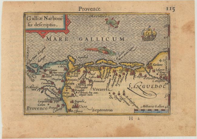
A charming miniature map of Gallia Narbonensis, the Roman province that is now part of Provence and Languedoc. The Rhone estuary is shown and the Mediterranean coastline from Marseille to Narbonne. The map is oriented with north at the bottom and is adorned with a tiny ship, two sea monsters, and a decorative title cartouche. French text on verso.
The map was first published by Cornelius Claesz and printed by Barent Langenes in the 1598 edition of the popular Map-treasury. For the 1599 edition, graduation lines and latitude numerals were added to one side of the border on most of the maps, which were again used for multiple editions through 1650. This is the second state with the added graduation lines from a French edition, printed by Albert Hendricks.
References: King (2nd ed.) p. 80-82; Van der Krogt (Vol. III) #4700:341.
Condition: B+
A nice impression with light toning and marginal soiling.