Catalog Archive
Auction 175, Lot 413

"Britania et Normadia cum Confinijs", Mercator/Hondius

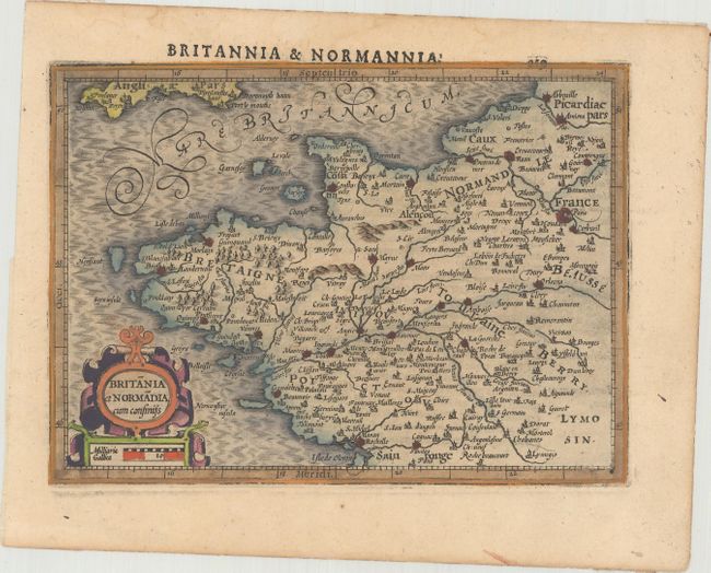
Subject: Northwestern France

Period: 1610 (circa)

Publication: Atlas Minor

Color: Hand Color

Size:
7.3 x 5.3 inches
18.5 x 13.5 cm
Download High Resolution Image
(or just click on image to launch the Zoom viewer)

Charming map of Brittany and Normandy filled with details of the topography, cities and villages. The map follows the coastline of France from Dieppe in the north to La Rochelle in the south, and east as far as Paris. The English Channel is also shown with the southern coast of England. Embellished with a strapwork title cartouche that incorporates a distance scale. Latin text on verso, published between 1610-1621.

References: Van der Krogt (Vol. III) #4001:351.

Condition: A

A dark impression on a watermarked sheet.

Estimate: $80 - $100

Sold for: $60

Closed on 11/13/2019

Archived