Catalog Archive
Auction 175, Lot 396

"The Seven United Provinces, Comprehending Holland, Zeeland, Utrecht, Gelders, Over-Yssel, Frieseland and Groningen; with the Land of Drent; Also Dutch Flanders and Dutch Brabant", Sayer, Robert

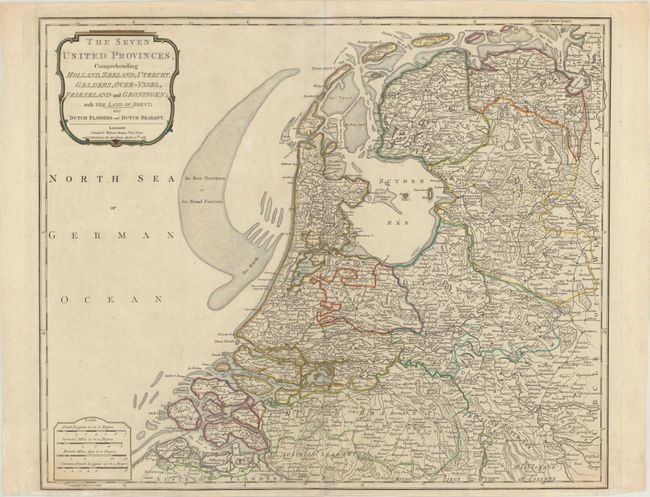
Subject: Netherlands

Period: 1788 (dated)

Publication: Describing the ... Universe

Color: Hand Color

Size:
22.7 x 18.7 inches
57.7 x 47.5 cm
Download High Resolution Image
(or just click on image to launch the Zoom viewer)

This densely engraved map of the Netherlands extends south to Antwerp, Belgium and east to Duisburg, Germany. Towns, roads, political boundaries, rivers, marshes, and sand banks are all shown in great detail. The North Sea is also labeled the German Ocean.

References:

Condition: B+

A fine impression on paper with a large fleur-de-lis coat of arms watermark and an archivally repaired centerfold separation that enters 4" into map at bottom. The bottom margin is narrow, but ample for framing.

Estimate: $140 - $170

Sold for: $80

Closed on 11/13/2019

Archived