Subject: Netherlands
Period: 1580 (circa)
Publication:
Color: Hand Color
Size:
19.6 x 14.6 inches
49.8 x 37.1 cm
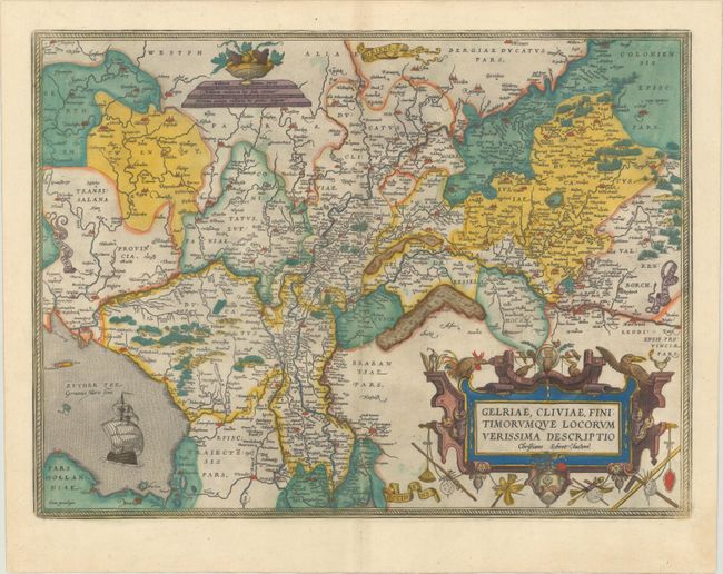
This superb map is Ortelius' first plate covering Gelderland. It is based on Christiaan Sgrothen's map of 1567 and is richly engraved with fine detail particularly along the rivers. The map is oriented with north to the left with ribbon cartouches marking the cardinal directions. A single large ship sails in the Zuyder Zee, a bowl of fruit sits atop the distance scales, and a painter's implements adorn the large title cartouche. This is the fourth state, with Latin text on verso, published in 1595.
References: Van den Broecke #61.2.
Condition: A
On a sheet with the crossed arrows watermark commonly found on Ortelius maps. There is some minor printer's ink residue and a couple errant spots of colorist's ink.