Subject: Finland
Period: 1659 (circa)
Publication: Nuevo Atlas
Color: Hand Color
Size:
20.6 x 17 inches
52.3 x 43.2 cm
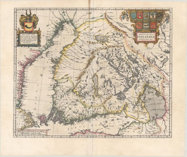
This superb map was the first separately printed map of Finland, and was also found in several editions of Blaeu's Atlas Maior and in a few composite atlases. The map is attributed to Anders Bure (1571-1646), a Swedish cartographer and mathematician. Bure, also known as Andreas Bureus, is best known for his 6-sheet map of Scandinavia and for serving as the first director of the Swedish land survey. The map shows the numerous lakes, rivers, and waterways in Finland, which was a Grand Duchy of the Swedish Empire at the time of publication. The title cartouche is adorned with the coats of arms of the various regions in Finland, held aloft by two putti. The map is dedicated to Gustav Horn, a Swedish/Finnish politician and military commander who was appointed Field Marshall by the King of Sweden at the outset of the Thirty Years War. Spanish text on verso, published between 1659-72.
References: Van der Krogt (Vol. II) #1470:2.
Condition: B+
An excellent impression with some soiling adjacent to the centerfold at top and some small abrasions along the centerfold. There is an extraneous vertical fold that has been pressed flat and archivally reinforced on verso to repair several separations and short adjacent tears.