Catalog Archive
Auction 175, Lot 382

"Pas Caerte van Texel tot aende Hoofden; Begrypende in sich de Zee-Custen van Vries-Land, Holland, Zeeland, Flaenderen; ende Oost-Cust van Engeland", Keulen, Johannes van
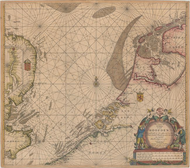
Subject: North Sea

Period: 1680 (circa)

Publication:

Color: Hand Color

Size:
23.3 x 20.4 inches
59.2 x 51.8 cm
Download High Resolution Image
(or just click on image to launch the Zoom viewer)

This handsome coastal chart details the North Sea between England and the Netherlands. The Frisian Islands are shown along the coast of Holland to just south of Dunkerque. The English coast is well detailed and includes an inset of the Thames River extending to London. The sea is full of rhumb lines, soundings, and shoals. There is a decorative cartouche at bottom right that has two figures with a map and a cross staff representing navigation. Engraved by Herman van Loon.

References:

Condition: B+

A dark impression printed on a double-thick sheet with light foxing, toning along the edges of the sheet, and a tiny centerfold separation at bottom.

Estimate: $475 - $600

Sold for: $350

Closed on 11/13/2019

Archived