Subject: Northern Ireland
Period: 1955 (dated)
Publication:
Color: Printed Color
Size:
21.6 x 29.8 inches
54.9 x 75.7 cm
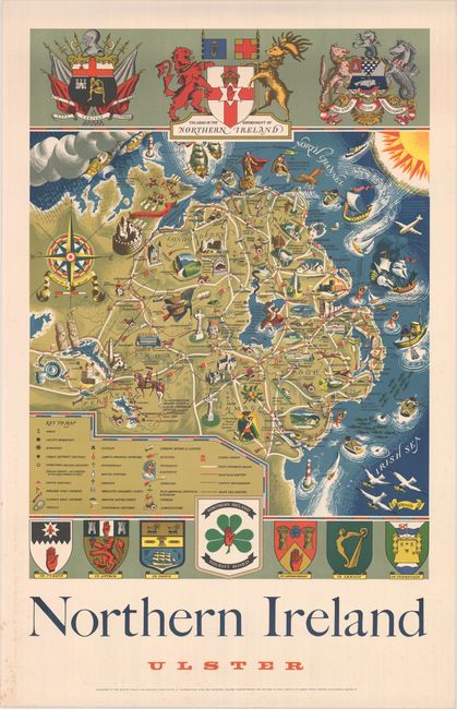
This gorgeous pictorial map of the province of Ulster in Northern Ireland was published by the British Travel and Holidays Association in conjunction with the Northern Ireland Tourist Board. The landscape is covered in elegant illustrations highlighting the sights, pastimes, history, and myths of the region. The illustrations include Robert the Bruce and a spider on Rathlin Island; St. Patrick's grave; the Siege of Londonderry; Slieve Guillion, "Haunt of heroes and legendary giants;" and Finn MacCoul hurling a rock, thereby creating Loch Neagh. A key at bottom left identifies a wide range of locations, including ports, youth hostels, golf courses, castles, cathedrals, megaliths, industrial centers, swimming areas, roads, and more. The map is surrounded by various coats of arms. Printed in Birmingham by James Upton.
References:
Condition: A
Vivid color with some marginal scattered foxing.