Subject: England & Wales; Southern Scotland
Period: 1935 (circa)
Publication:
Color: Printed Color
Size:
18.9 x 28.7 inches
48 x 72.9 cm
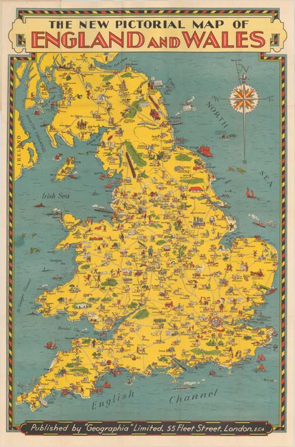
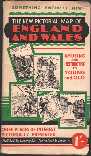
This charming pictorial map was published by "Geographia" Ltd. and illustrates notable locations in England, Wales, the Isle of Man, and part of Scotland. London is principally represented by the London Bridge; Leeds is marked by bales of wool; Oxford is accompanied by an image of a professor with students; Cardiff Castle, the National Museum of Wales, and the Welsh National Memorial define Cardiff; and Glasgow is depicted as a grouping of factories ("They build one or two ships on the Clyde"). Literary figures are sprinkled throughout the landscape, with portraits of Shakespeare, Charles Dickens, Robert Burns, Alfred, Lord Tennyson, Lewis Carroll, Wordsworth, Shelley, Coleridge, George Eliot, and Sir Walter Scott appearing near their hometowns. There are many other sites depicted on the map: Stonehenge; Sir Walter Raleigh smoking his first pipe; Canterbury pilgrims; a bathing man in Bath; Henry VIII on a hunt; Oliver Cromwell outside Lichfield; Lincoln Cathedral; Friar Tuck; golfing in Scotland; and more. The map is adorned with an ornate compass rose and is surrounded by a decorative border. It folds into illustrated paper wrappers (4.3 x 7.5") with a one shilling price.
References:
Condition: A
The map, issued folding, is clean, bright and in near fine condition. Paper wrappers have light wear, and there is a damp stain on the rear wrapper that does not affect the map image.