Catalog Archive
Auction 175, Lot 331

"Carta de la Costa Comprendida Entre Bahia Blanca y Bahia de la Union Segun los Trabajos Ingleses Mas Recientes", Direccion de Hidrografia

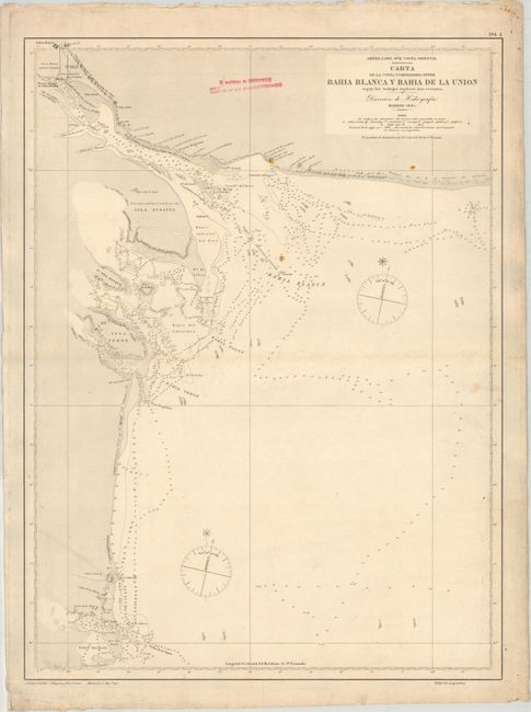
Subject: Bahia Blanca, Argentina

Period: 1907 (dated)

Publication:

Color: Black & White

Size:
18.6 x 25.1 inches
47.2 x 63.8 cm
Download High Resolution Image
(or just click on image to launch the Zoom viewer)

This detailed navigation chart focuses on the coastline surrounding Bahia Blanca, just southwest of Buenos Aires. The chart is filled with depth soundings, rocks, shoals, and navigational notations. The chart was originally created in 1885 and includes updates through 1907. Engraved by J. Gaboan. The pink stamp at top indicates the location of the Greenwich Meridian at a distance of 6 degrees, 12 minutes and 12 seconds from the San Fernando Meridian.

References:

Condition: B+

A sturdy sheet with a "P" watermark, a horizontal crease, and light soiling. The lighthouses are highlighted in contemporary hand color.

Estimate: $40 - $50

Sold for: $10

Closed on 11/13/2019

Archived