Subject: Guadeloupe
Period: 1823 (circa)
Publication: Les Antilles Francaises
Color: Hand Color
Size:
24 x 18.1 inches
61 x 46 cm
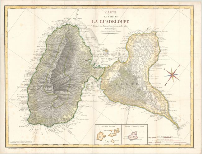
An uncommon map of this French island in the Lesser Antilles with an area of about 500 square miles. It is actually two islands divided by a narrow channel, here called the Rivere Salee. A remarkable amount of detail is provided along the coastline and throughout the interior with numerous roads and buildings shown. Two insets at bottom, "Iles des Saintes" and "Iles de la Petite Terre." A handsome chart with a large compass rose and three distance scales. Drawn by Desmadryl, lithographed by C. de Lasteyrie and published by Colonel Boyer-Peyreleau.
References:
Condition: B+
Issued folding with light foxing and archival repairs to a 4" tear below the title and a 2.5" tear at left. The left margin has been extended to accommodate framing.