Catalog Archive
Auction 175, Lot 294
"Carte de l'Isle d'Hayti Aujourd'hui l'Espagnole, ou l'Isle de St. Domingue avec les Isles Voisines Suivant la Decouverte de l'Annee 1492 et les Premiers Etablissemens des Espagnols", Bellin, Jacques Nicolas
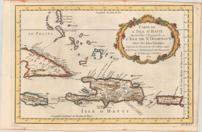
Subject: Hispaniola
Period: 1754 (dated)
Publication: Histoire Generale des Voyages
Color: Hand Color
Size:
13.3 x 8.8 inches
33.8 x 22.4 cm
Download High Resolution Image
(or just click on image to launch the Zoom viewer)
(or just click on image to launch the Zoom viewer)