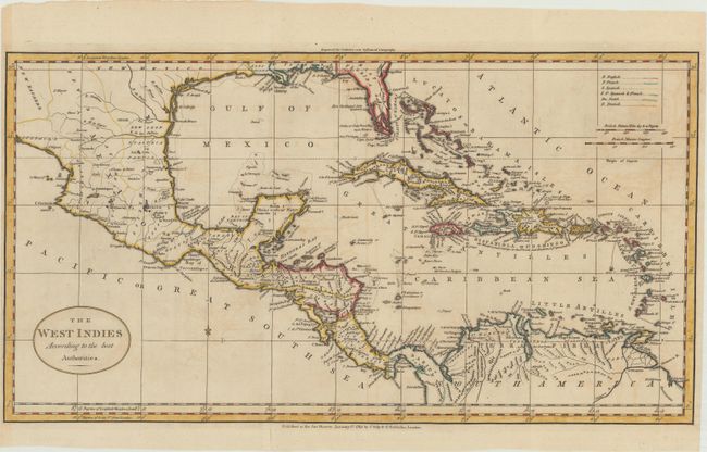
Subject: Gulf of Mexico & Caribbean
Period: 1785 (dated)
Publication:
Color: Hand Color
Size:
20.9 x 11.3 inches
53.1 x 28.7 cm
This early map of the Caribbean provides excellent detail on the islands to include northern South America, all of Central America and most of Mexico. Extends to show the delta of the Mississippi River. Florida is East Florida and the southern portion is oddly shaped with numerous waterways slicing the peninsula into many islands. The region of Texas is labeled New Mexico. With a simple oval title cartouche. Legend at upper right was to indicate colonial possession, but remains uncolored in this edition. Published by Charles Dilly and G. Robinson on January 1, 1785.
References:
Condition: B+
A dark impression with light offsetting and a small hole in the top blank margin. The left margin is narrow but sufficient for framing.