Subject: Central America, Panama Canal
Period: 1838-39 (published)
Publication:
Color: Black & White
This lot contains two early reports concerning U.S. efforts to construct the Panama Canal.
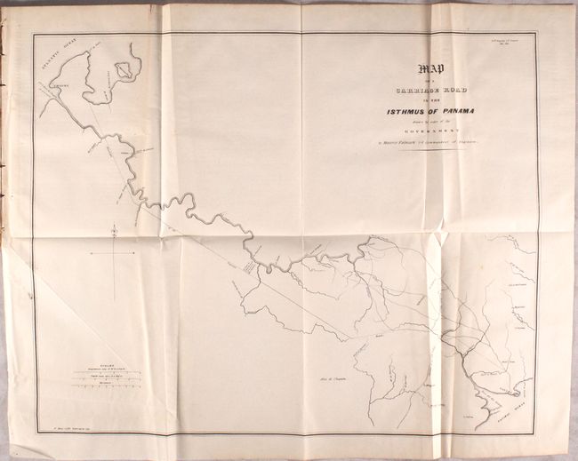
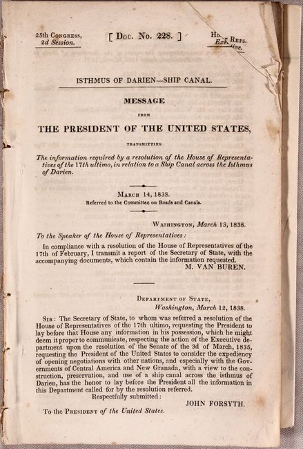
A. Map of a Carriage Road in the Isthmus of Panama Drawn by Order of the Government [bound in] Isthmus of Darien - Ship Canal. Message from the President of the United States..., published 1838 (map - 18.8 x 14.9"). This map and report reflect a very early and virtually unknown American interest in what became the Panama Canal. The map was prepared by Maurice Falmark, 2nd Commandant of Engineers. It shows Panama City at lower right with the projected road running northwest to Lemon Bay near Charges, today's Colon. The map is still bound in the original report "Isthmus of Darien - Ship Canal. Message from the President of the United States." This 103-page government document describes Charles Biddle's survey of Panama at the order of President Jackson. The various reports and memos are transmitted by John Forsyth, Department of State to President Van Buren. Condition: The folding map is very good with some extraneous creasing and a few spots of foxing. Report has light toning in the second half only.
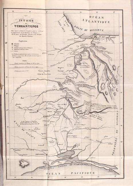
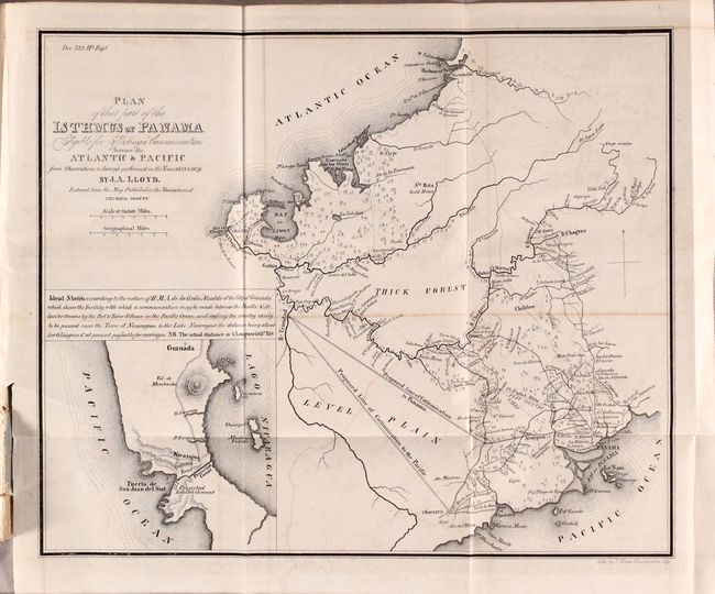
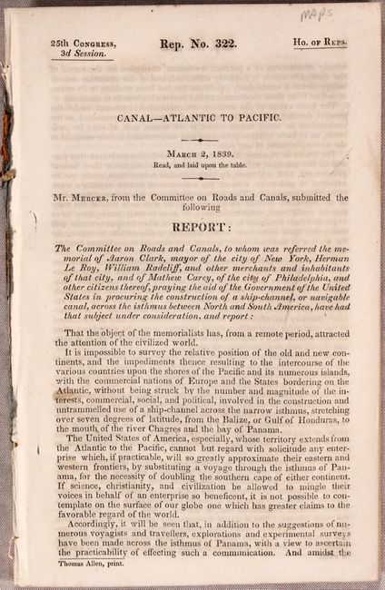
B. [Report with Maps] Canal - Atlantic to Pacific, published 1839 (5.6 x 8.7"). This 167 page report from the House Committee on Roads and Canals details several possible scenarios for opening a "communication" (railroad or canal) between the Atlantic and Pacific Oceans, with a recommendation that the House of Representatives approve a resolution for the President to enter negotiations with the government of Panama to create a canal. The report includes a profile view from Lake Nicaragua to the Pacific Ocean and the following five maps:
Map Showing the Route from New-York to the Isthmus of Panama (14.2 x 7.1").
Isthme de Tehuantepec (15.6 x 10.8").
Map of the Western Coast of America with the Intended Track of the Steamers (6.9 x 12.9").
Mapa Corografica de un Camino Carretero en el Istmo de Panama… (9.3 x 7.2").
Plan of That Part of the Isthmus of Panama Eligible for Effecting a Communication between the Atlantic & Pacific…, by J.A. Lloyd (10.2 x 8.5").
Condition: The maps are all near fine with the exception of the Western Coast of America map that has some offsetting. Text is very good with occasional light toning.
References:
Condition: B+
See description above.