Catalog Archive
Auction 175, Lot 269

"Karte der Provinzen Tabasco, Chiapa, Verapaz, Guatimala, Honduras und Yucatan...", Bellin, Jacques Nicolas

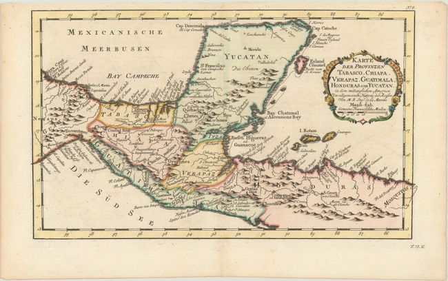
Subject: Southern Mexico & Central America

Period: 1758 (published)

Publication: Allgemeine Historie der Reisen zu Wasser und zu Lande

Color: Hand Color

Size:
13.3 x 7.9 inches
33.8 x 20.1 cm
Download High Resolution Image
(or just click on image to launch the Zoom viewer)

Nice detailed map of the Yucatan peninsula and northern Central America. Locates primary harbors, shoals and offshore islands including Cosumel, Ruatan and Bonacca. Guatemala is limited to a narrow strip along the Pacific coast and El Salvador has yet to be carved out of Honduras. Decorated with a fine title cartouche. Published in a German edition of Prevost's l'Histoire Generale des Voyages.

References:

Condition: A

A sharp impression on a clean, bright sheet with a hint of toning along the centerfold at bottom.

Estimate: $100 - $130

Sold for: $75

Closed on 11/13/2019

Archived