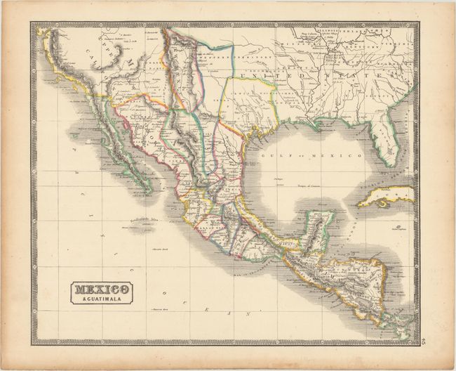
Subject: Southern United States, Mexico & Central America
Period: 1846 (circa)
Publication: The People's Atlas…
Color: Hand Color
Size:
13.8 x 11.5 inches
35.1 x 29.2 cm
The Republic of Texas was a sovereign state in North America from 1836 to 1845. It was formed as a break-away republic from Mexico by the Texas Revolution. The nation claimed a large region that included all of the present state of Texas together with part of the former Mexican region of New Mexico (parts of present-day New Mexico, Oklahoma, Kansas, Colorado, and Wyoming). The eastern boundary with the United States was defined by the Adams-Onís Treaty between the United States and Spain, in 1819. Its southern and western-most boundary with Mexico was under dispute throughout the existence of the republic, with Texas claiming that the boundary was the Rio Grande, and Mexico claiming the Nueces River as the boundary.
This uncommon, if not rare, Scottish map covers the southern United States, Mexico and Central America and features an independent Republic of Texas in its small configuration. Surrounded by a decorative keyboard-style border.
References: cf. Rumsey #5161.050.
Condition: A
Light toning along the edges of the sheet.