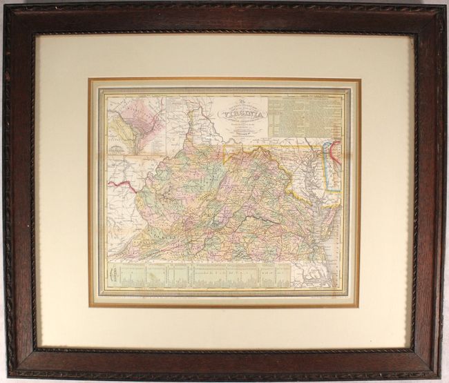
Subject: Virginia & West Virginia
Period: 1853 (dated)
Publication:
Color: Hand Color
Size:
15.6 x 12.9 inches
39.6 x 32.8 cm
This attractive map of the state is filled with detail of counties, cities, roads, railroads, and canals. County development is current to the date of this map, with the appearance of Craig County (1851) in the southwest portion of the state and prior to the creation of Calhoun (1856). At top right is an inset with a detailed explanation of the "Principal Rail Road & Stage Routes through Virginia." A second inset at top left is a city plan of Washington D.C., and the principal steamship routes from various cities are listed at bottom. Fancy titling and decorative border. Engraved by E. Yeager and F. Dankworth. The Thomas, Cowperthwait Company purchased the copyright to Mitchell's maps in 1850.
References:
Condition: B+
Issued folding with some light staining along the fold lines. Narrow margins as issued. Not examined outside of frame - sold as is and not subject to return.