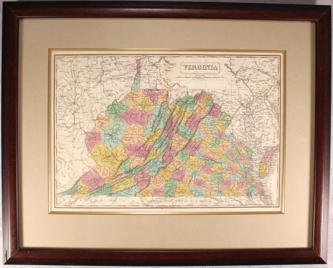
Subject: Virginia & West Virginia
Period: 1826 (circa)
Publication: A New General Atlas...
Color: Hand Color
Size:
18.8 x 12.8 inches
47.8 x 32.5 cm
Finely's maps employ a delicate and elegant engraving style and provided extensive topographical and watershed information. He was the dominant map maker in the United States in the early 1820s into the 1830s. His atlases were very successful, outselling rival atlases by Carey & Lea, and Tanner. His maps were printed on high quality paper and were routinely corrected and updated.
This handsome map of the state details county seats, roads, towns and settlements, and watershed. Development is primarily east of the Allegheny Mountains, but the entire state (including today's West Virginia) is divided by county with county seats assigned to all. County development suggests the map is dated circa 1826: Alleghany has just formed from Bath (1822), Logan County is present (1824), but Floyd is not (1831). Engraved by J.H. Young. According to Ristow, Finley published his atlases between 1824 to 1834, with separate issues published in the years 1824, 26, 29, 30, 31, 33 and 1834.
References:
Condition: B+
Light offsetting. Not examined outside of frame - sold as is and not subject to return.