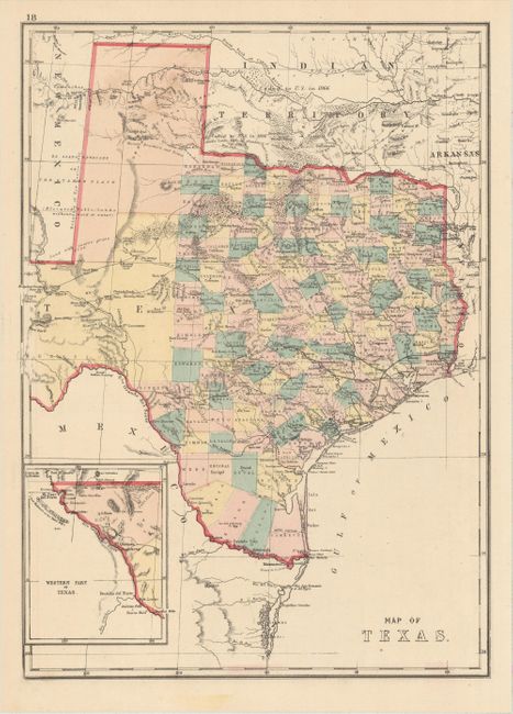
Subject: Texas
Period: 1875 (circa)
Publication:
Color: Hand Color
Size:
12.3 x 16.9 inches
31.2 x 42.9 cm
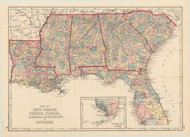
This is an interesting map of Texas that uses longitudinal projection lines, which increase in width the further south one goes, to more accurately reflect the curvature of the earth and distance between degrees of longitude. It includes superb detail of trails, ponds, springs, forts, and railroads along with additional information on the region's natural resources (gypsum, salt, arable land, timber, sand, course grass, and forests labeled Mesquite Openings). Also locates the Padre Silver Mine (now lost) east of El Paso in the inset map and emigrant crossings on the Pecos River. County development extends beyond the 100th meridian, with the large El Paso, Presidio, and Young territories still occupying the west. The "Western Part of Texas" is shown in an inset on the same scale as the main map. The map was likely published by Hardesty & Co., in an edition of Historical Atlas of the World… with the verso containing a map of the southern United States from South Carolina to Louisiana.
References:
Condition: A
Near fine with very minor soiling at top.