Subject: Rhode Island
Period: 1933-39 (dated)
Publication:
Color: Printed Color
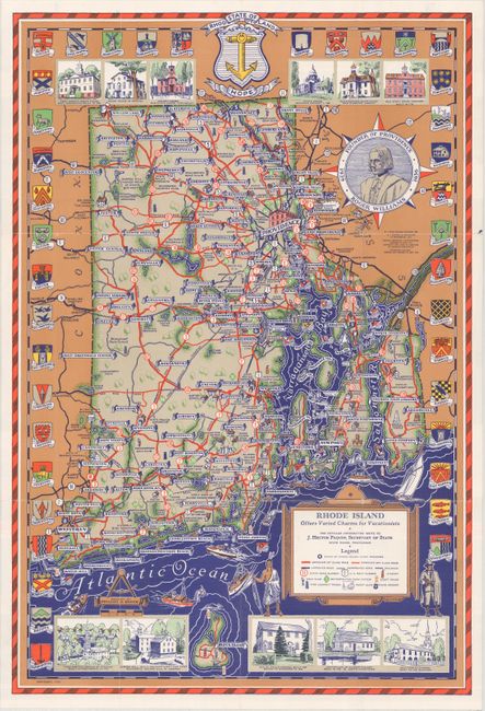
A. Rhode Island Offers Varied Charms for Vacationists, by State of Rhode Island and Providence Plantations, dated 1939 (13.9 x 20.6"). This pictorial map of the state was designed by Phillips D. Booth and emphasizes the improved road network in the state. Cities and towns are identified on scrolls, with 39 city coats of arms surrounding the map. Includes little vignettes of historical buildings at top and bottom, and a compass rose with a portrait of Roger Williams at center. Related text and illustrations on verso. Self-folding. Condition: There are a few tiny splits at fold intersections, otherwise fine.
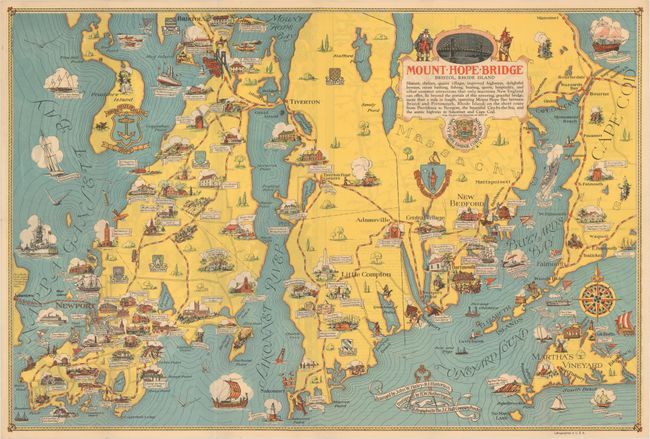
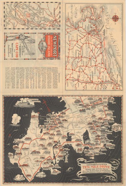
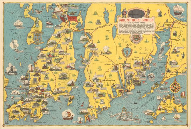
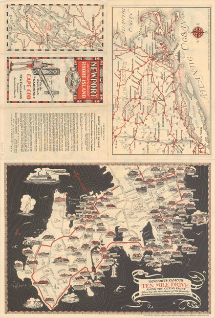
B. [2 Examples] Newport and the Historic Island of Rhode Island, by Mount Hope Bridge Corporation, dated 1933 & 1939 (25.7 x 17.3"). A charming pictorial map extending from Bristol and Newport east to Cape Cod and Martha's Vineyard showing "historic shrines, quaint villages, improved highways, delightful byways, ocean bathing, fishing, boating, sports, hospitality, and other summer attractions that only maritime New England can offer..." The text indicates that these activities are enabled by the one-mile Mount Hope Bridge, connecting Bristol to points east. Filled with illustrations on both land and water along with historical notes. The verso contains a smaller pictorial map of Newport’s Famous Ten Mile Drive. Designed by H.W. Hetherington and lithographed by the J.C. Hall Company. Condition: Both examples are clean and colorful.
References: Rumsey #8820 & #8737.
Condition: A
Issued folding. See description above for additional details.