Subject: Pennsylvania
Period: 1796 (published)
Publication: The American Atlas
Color: Black & White
Size:
17.8 x 12.7 inches
45.2 x 32.3 cm
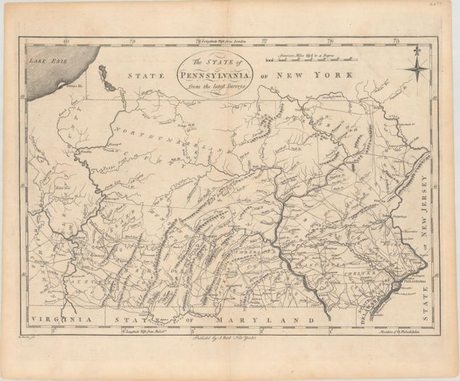
This map is the first state of Reid's early map of Pennsylvania which was based on Reading Howell's map of 1792, which was the first detailed map to correctly show the boundaries. On this map the New York - Pennsylvania boundary has been updated while the old one has been erased from the plate. It includes topography, towns, donation lands, counties and townships, as well as a remarkable network of early roads. The Allegheny, Ohio, Schuylkill, Little Schuylkill, Delaware, and Potomac rivers are delineated. Engraved by D. Martin. This map was also published in Winterbotham's America.
References: Wheat & Brun #450.
Condition: B+
A nice impression with a few minor spots and a faint horizontal crease across the middle of the map image.