Subject: Oklahoma, Oil
Period: 1937 (dated)
Publication:
Color: Black & White
Size:
31 x 21 inches
78.7 x 53.3 cm
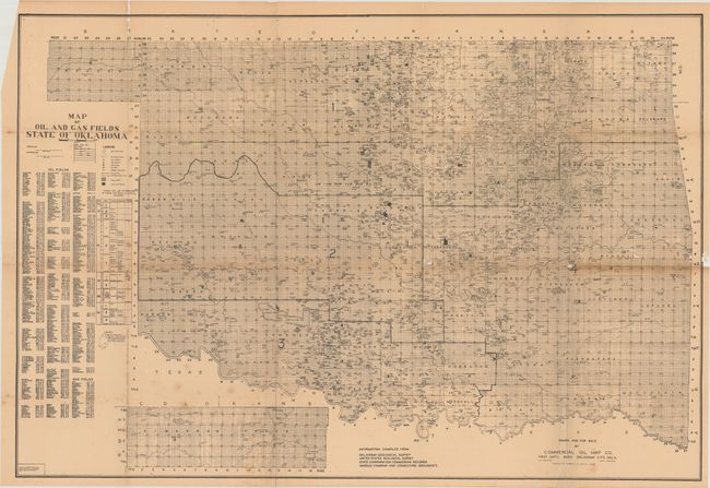
This map was published by the obscure Commercial Oil Map Co. and compiled from information from the Oklahoma Geological Survey, the U.S. Geological Survey, and consulting geologists. Highly detailed, the map identifies numerous oil and gas pools, fields, wells, and wildcat locations. Includes a complete index to oil and gas fields which are keyed to the map. The panhandle is shown in an inset on the same scale at bottom. Dated 1937 and revised to 1938. No past sales records and only one institutional example found on OCLC.
References:
Condition: B
Issued folding with light toning, scattered foxing, and small areas of loss near the fold lines primarily at right. Several fold separations have been closed on verso with archival tape.