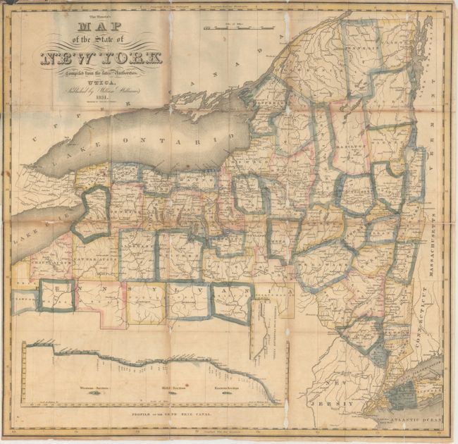
Subject: New York
Period: 1831 (dated)
Publication:
Color: Hand Color
Size:
20.7 x 19.8 inches
52.6 x 50.3 cm
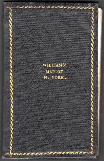
This scare pocket map presents the counties in a rich, lovely outline color with the recently completed Erie Canal depicted from Albany to Lake Erie. County development is current to the publication date. There are two insets; "Profile of the Erie Canal" and and a smaller "Profile of the Champlain Canal." This edition does not contain a panel of descriptive text along the right side of the map found on some earlier examples. Engraved by Balch & Stiles. Map folds into original black leather covers (3.3 x 5.4") with gilt-stamped title.
References:
Condition: B
Issued folding with light toning, faint offsetting, and minor foxing. There are several small areas of loss along the fold lines that have been repaired on verso with archival tissue. Ex-library stamp on verso. Covers are very good with some minor repaired chips on the rear cover.