Subject: Virginia City, Nevada
Period: 1872-80 (circa)
Publication:
Color:
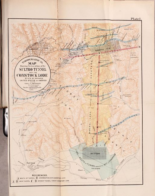
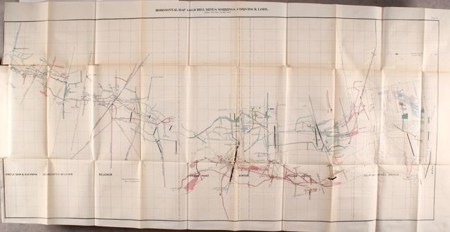
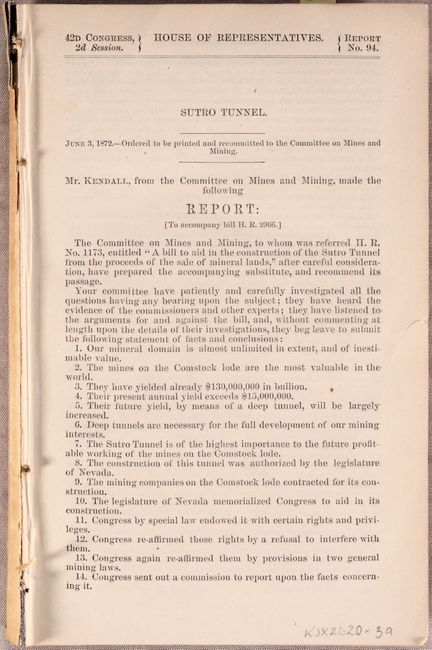
A. [Complete Report with 12 Plates] Sutro Tunnel, by U.S. Government, from H.R. Doc. 94, 42nd Congress, 2nd Session, published 1872, printed color (5.8 x 9.0"). This 450 page report is the more desirable edition with 12 folding maps and charts including the Topographical Map Showing the Location of the Sultro [sic] Tunnel and the Comstock Lode. The six mile tunnel was intended to provide better access to the Comstock Lode and offer miners a safer access point from nearby Sutro. In addition to the tunnel, the map shows mineral lands, mining claims, mills, and more. The lengthy report text includes the bill and comprehensive “Report of the Commission and Evidence…in Regard to the Sutro Tunnel.” The tunnel was completed in 1878. Disbound. Condition: Maps are very good with occasional tape repairs and a couple of old library stamps on verso.
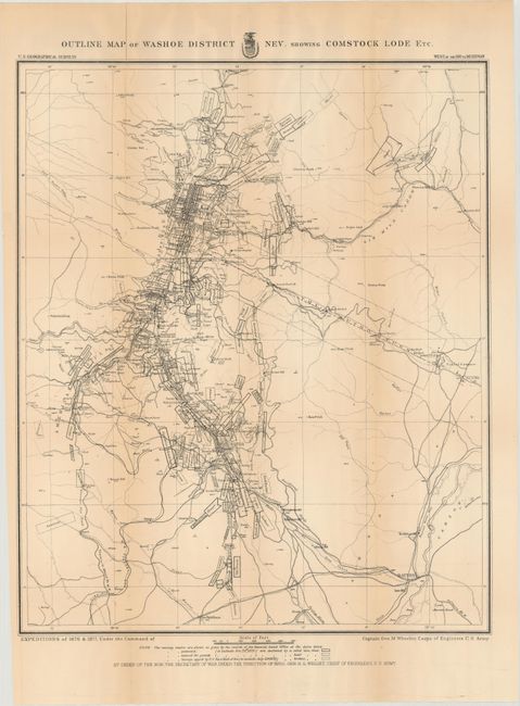
B. Outline Map of Washoe District Nev. Showing Comstock Lode Etc., by Capt. George M. Wheeler, circa 1880, black & white (17.6 x 21.3"). A remarkably detailed map that shows the gold and silver operations in the vicinity of Virginia City. The map is a product of Capt. G.M. Wheeler's Expeditions of 1876-77 for the "Surveys West of the 100th Meridian." It is difficult to overstate the number of claims shown; perhaps as many as 100 in a patchwork mosaic covering the region so completely it is difficult to see place names. Scores of mills including Sherman, French's, Humphreys, Nevada and many more are identified. The Sutro Tunnel is detailed with the tunnel entrance located. Hundreds of settlements and villages, roads and trails and much, much more are presented. Condition: Issued folding with light toning along the fold lines and a few short fold separations that have been closed on verso with archival tape.
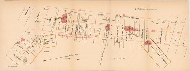
C. [Untitled Map], by U.S. Land Commission, from House Ex. Doc. 46, circa 1880, printed color (23.5 x 7.8"). This map shows "Bonanza" sites, mining claims, and the "Line of the Present Workings on Comstock Lode." The Sutro Tunnel is located near the middle of the map. North is oriented to the top right. Condition: Faint offsetting.
The region surrounding the Comstock Lode first drew the interest of gold prospectors in the 1850s. They struggled with the heavy, gooey mud that clung to picks and shovels. When assayed, this troublesome muck proved to contain silver ore worth over $2,000 a ton in 1859 dollars (not counting the gold content). This rich lode caught the attention of President Lincoln who realized this mineral wealth could help keep the Union solvent during the Civil War. In 1864 he made Nevada a state, bypassing the sticky problem that it did not contain enough people to be constitutionally eligible for statehood.
References:
Condition: B+
See description above.