Subject: Massachusetts
Period: 1964 (circa)
Publication:
Color: Printed Color
Size:
32.6 x 20.4 inches
82.8 x 51.8 cm
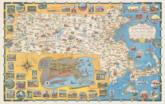
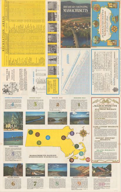
This colorful pictorial map of the state was issued to coincide with the World's Fair in New York City. It was designed "to help you feel at home in the Bay State" and includes numerous illustrations of important buildings, recreational activities, natural features, and copious notations. Below the map is an inset showing the major routes from the World's Fair to the "Massachusetts Year Round Vacation Areas." The entire sheet is surrounded by vignettes of local attractions including the Boston Public Library, Bunker Hill monument, Nantucket, and "A typical Mass. Motel." Related text and illustrations on verso. Designed and drawn by Ernest Dudley Chase, who was a leader in pictorial mapmaking during the middle 20th century.
References: Hornsby (Picturing America) pp. 31-34.
Condition: A
A colorful example on a bright sheet with a few tiny stains confined to the blank margins. Issued folding.