Subject: New Orleans, Louisiana
Period: 1769 (circa)
Publication: Nieuwe en Beknopte Hand-Atlas
Color: Black & White
Size:
17.4 x 12.9 inches
44.2 x 32.8 cm
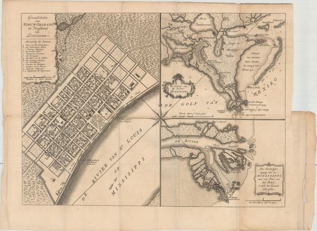
This handsome sheet consists of three maps composed around a large compass rose. It is Tirion's version of the map first drawn by De la Tour in 1720, only two years after the founding of New Orleans. The first map is a plan of the city of New Orleans (now the French Quarter) vividly depicting its protective canal, barracks, and quays. The second is a map of the vicinity of New Orleans including the delta and surrounding bayou. The third is a map of the location of Fort la Balisle at the mouth of the river, which sank into the marsh in the late 1700's. Each map has a delicately engraved title cartouche, and a lovely compass rose connects all three maps.
References: Goss (NA) #63; Shirley (BL Atlases) T.TIR-2a; cf. Van Ermen #39.
Condition: B+
Issued folding with faint offsetting and light toning along the right fold. There is a vertical printer's crease near the middle of the map image, and a short binding tear confined to the right blank margin that has been closed on verso with archival tape.