Catalog Archive
Auction 175, Lot 177
"Yosemite National Park Showing Boundaries Established by Act of Congress Approved June 11, 1906 and Lands Eliminated Therefrom and Placed in the Sierra Forest Reservation", U.S. Government
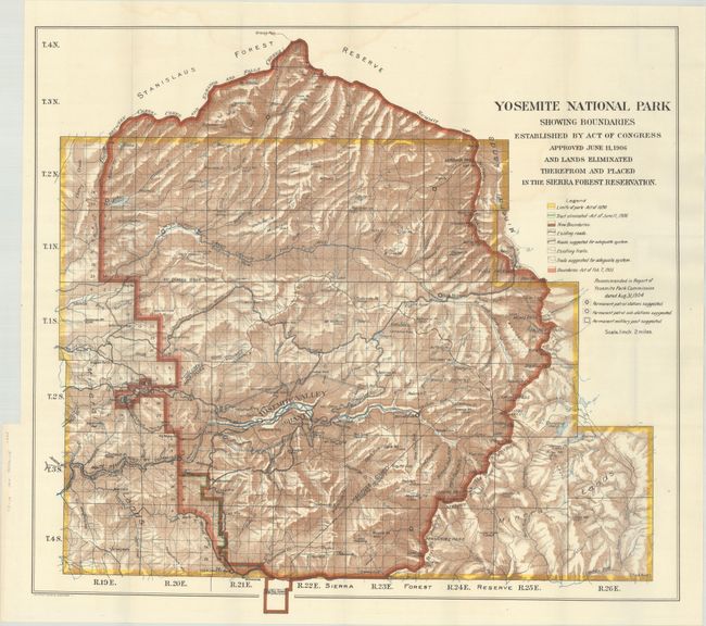
Subject: Yosemite, California
Period: 1906 (dated)
Publication:
Color: Printed Color
Size:
27.2 x 24.7 inches
69.1 x 62.7 cm
Download High Resolution Image
(or just click on image to launch the Zoom viewer)
(or just click on image to launch the Zoom viewer)