Subject: Upper Midwestern United States
Period: 1812 (circa)
Publication: Brookes' Gazetteer
Color: Black & White
Size:
9.7 x 7.7 inches
24.6 x 19.6 cm
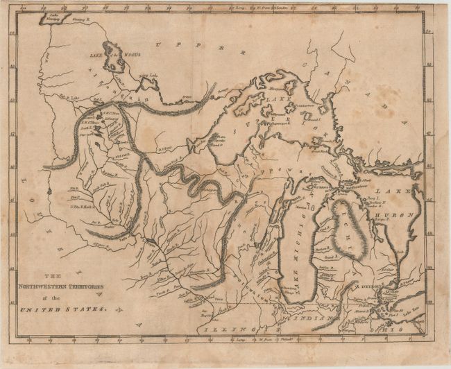
Mathew Carey was a seminal figure in early American publishing; establishing the first publishing firm to specialize in cartography and issuing the first atlas devoted exclusively to American maps. He set up an elaborate cottage system of craftsmen for compiling, engraving, printing, and coloring maps. This practice was emulated by later American cartographic publishers such as John Melish and Henry S. Tanner. The American Atlas concept was also adopted by other publishers in both the United States and Europe.
This map covers the region from Michigan through Lake of the Woods and Lake Winnipeg. The Great Lakes are somewhat distorted and include the spurious islands in Lake Superior including one named Phillipeaux I. The map names Michigan, Illinois, Indiana, Ohio, and the settlements of Detroit, Sandwich, Miami B., F. St. Claire, F. Dearborne, Chicago, and more. The northern border of Illinois is shown level with the top of Indiana at 42°, which places Chicago in the Northwestern Territory. Spurious mountain ranges, engraved in hachure, are shown snaking across the territory.
References:
Condition: B
Issued folding with toning and scattered foxing. There is a light dampstain along the right border and a narrow top margin.