Subject: Central United States
Period: 1836 (dated)
Publication:
Color:
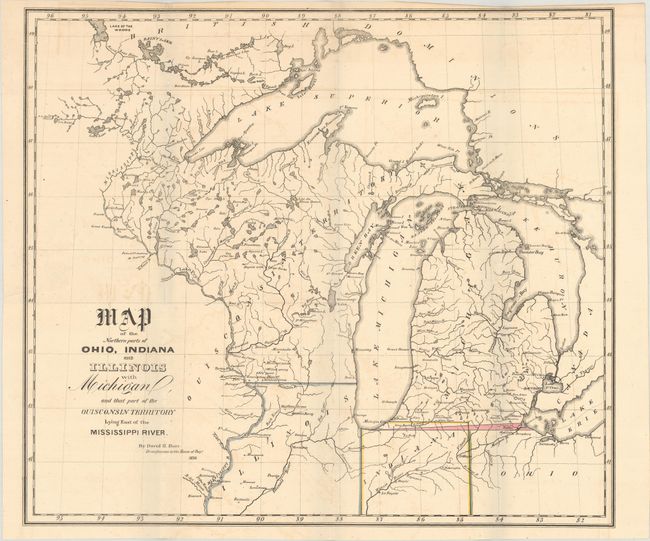
A. Map of the Northern Parts of Ohio, Indiana and Illinois with Michigan, and That Part of the Ouisconsin Territory Lying East of the Mississippi River, hand color (14.8 x 12.9"). This map covers the region from northern Ohio west to the Mississippi River and north to Lake of the Woods. A small but important sliver of land highlighted in pink reflects a boundary dispute between Ohio and Michigan - one that saw Ohio block admission of Michigan to the Union until the question was settled. The map also notes Indiana's revised northern boundary. Reference: Claussen & Friis #144. Condition: Faint offsetting with two small tears at left that have been closed on verso with archival tape. (B+)
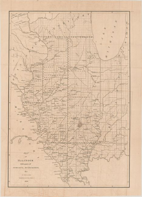
B. Map of Illinois with Parts of Indiana, Ouisconsin, &c., black & white (12.6 x 18.2"). This detailed map provides information on the counties, watershed, settlements, Indian villages and railroads. The proposed routes of the Illinois Central Railroad, Alton and Mount Carmel Railroad, Hillsboro Rail Road, Northern Cross Rail Road, and the Warsaw and Peoria Rail Road are shown. The Indian land boundary and the area ceded to the U.S. by the Sioux, Sac, and Fox nations are noted. Wisconsin came from the term "Ouisconsin" which is believed to mean "grassy place" in the Cheppewa tongue. Reference: Claussen & Friis #146. Condition: There is offsetting with a small stain at center. (B)
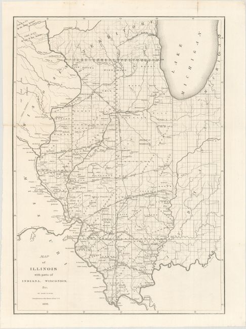
C. Map of Illinois with Parts of Indiana, Wisconsin, &c., black & white (12.8 x 17.9"). While dated 1836, this map was published circa 1838 with the modern spelling of Wisconsin and many additions to the previous version above, including railroads, canals, and new county development. Reference: Claussen & Friis #216. Condition: (A+)
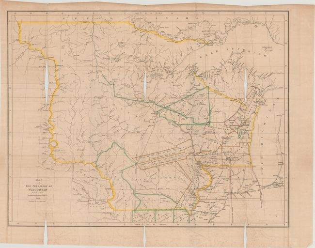
D. Map of the Territory of Wisconsin, hand color (26.4 x 20.4"). This scarce and important map of Wisconsin Territory extends to include all of present-day Minnesota, the Upper Peninsula of Michigan, and most of the Dakotas. The western extent is the Missouri River up to the White Earth River. Outline coloring shows eight districts and numerous land parcels allocated to the various Indian tribes and areas ceded by the Sioux, Sac, and Fox. The map is filled with detail of forts, ferries, towns, and villages including Wisconsin City and Milwaukee. Hydrology is well developed and there is considerable geographic data. References: Claussen & Friis #145; Karpinsky (MI) #138; Phillips (M) p.1075. Condition: Light offsetting with an errant binder's cut that has resulted in three areas of loss along the upper fold, as well as three much smaller areas along the bottom border. (C)
References:
Condition:
Issued folding. See description above for additional details.