Subject: Southern United States
Period: 1816 (circa)
Publication: A New and Elegant General Atlas...
Color: Black & White
Size:
10.4 x 8.4 inches
26.4 x 21.3 cm
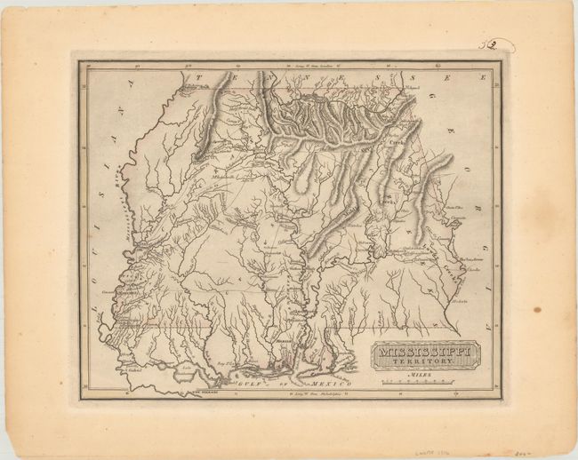
This early map of Mississippi Territory covers the region of present-day Mississippi and Alabama. At the extreme northwest corner of the map is Fort Pickering on Chickasaw Bluff, near the future site of Memphis. The map locates Indian tribes and villages along with a few early settlements and forts. Numerous Indian trails and early roads crisscross the interior. Published in Lucas' rare A New and Elegant General Atlas, which is known as one of the finest general atlases produced in the U.S. at the time, due to the high quality paper and superior engraving quality.
References: Phillips (Atlases) #3542-53.
Condition: A
A nice impression with light toning and a few faint spots in the blank margins.