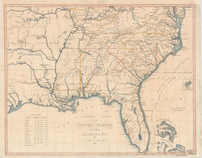
Subject: Southern United States
Period: 1816 (dated)
Publication: Atlas til Friherre Klickowstroms Bref om de Forente Staterne
Color: Hand Color
Size:
19.9 x 15.8 inches
50.5 x 40.1 cm
This rarely seen map is based on John Melish's map of 1816 and comes from the Swedish atlas produced by A.L. Klinckowstrom and published circa 1824. It covers the southern part of the United States from the Missouri Territory to the Atlantic, including most of Virginia and the southern tips of Illinois, Indiana, and Ohio. The Bahama Islands are detailed, with one of the islands noted as the Center of the World. The map shows the Gulf Stream, roads, forts, and settlements in Missouri Territory. The populations of the states, territories, and the Bahama islands are noted in an inset at the lower left.
References: Phillips (Atlases) 1375-15.
Condition: B+
On a sheet with a "C & I. Honig" watermark. There are numerous short edge tears at bottom that have been repaired on verso with archival materials. Two chips in the top right and bottom right corners have been professionally infilled with a tiny portion of the neatline at bottom replaced in facsimile.