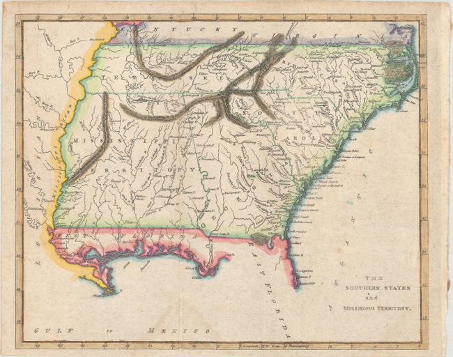
Subject: Southern United States
Period: 1814 (circa)
Publication: A General Atlas
Color: Hand Color
Size:
9.5 x 7.7 inches
24.1 x 19.6 cm
This is a scarce map that covers current-day Tennessee, North Carolina, South Carolina, Georgia, Alabama, Mississippi, and northern Florida. The oversized Mississippi Territory includes today's Alabama, thus stretching to the Mississippi River. Political boundaries are circa 1812, as the Mobile district along the Gulf of Mexico is not yet annexed to the Mississippi Territory. The Florida panhandle is designated as West Florida, while the area west of the Mississippi River is Louisiana. Rumsey (#4864) is an uncolored edition of this map, published in 1816 by Mathew Carey and Benjamin Warner, although an 1814 edition at Yale is also noted. Rumsey attributes this map, along with the other regional maps in A General Atlas, to Warner.
References: Rumsey #4864.009.
Condition: B+
Issued folding with two faint dampstains at bottom and some minor foxing.