Catalog Archive
Auction 175, Lot 142

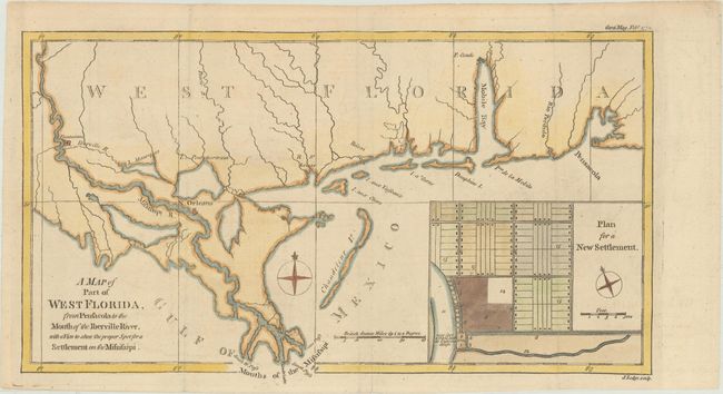
"A Map of Part of West Florida, from Pensacola to the Mouth of the Iberville River, with a View to Shew the Proper Spot for a Settlement on the Mississipi", Lodge, John

Subject: Colonial Southern United States, Florida

Period: 1772 (dated)

Publication: Gentleman's Magazine

Color: Hand Color

Size:
13.5 x 7.6 inches
34.3 x 19.3 cm
Download High Resolution Image
(or just click on image to launch the Zoom viewer)

This copper engraved map features Mobile Bay and Fort Conde, New Orleans and locates Plantations along the Mississippi well north of New Orleans. The large inset "Plan for a New Settlement" shows the proposed street layout and wharf and docks along the river. It is reported that this map was published in response to reports that the British government was considering the settlement of a colony on the banks of the Mississippi; the point suggested was near today's Baton Rouge. The area labeled 'Plantations' on the map is identical to the inset plan.

References: Jolly #GENT-217; Sellers & Van Ee #1650.

Condition: A

Issued folding, now flattened, with minor toning.

Estimate: $240 - $300

Sold for: $160

Closed on 11/13/2019

Archived