Subject: Western Hemisphere - America
Period: 1789 (dated)
Publication:
Color: Hand Color
Size:
21.1 x 19.4 inches
53.6 x 49.3 cm
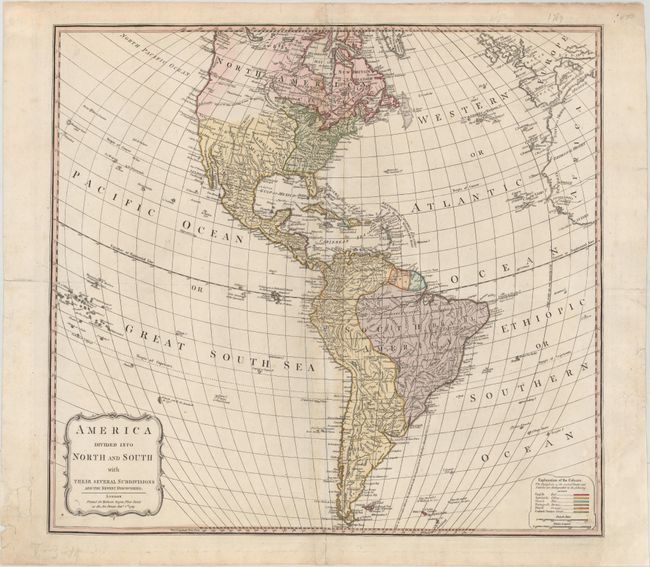
This uncommon map of the Americas is by one of the most prominent English cartographers of the late 18th century. The focus of the map is on the political boundaries and colonial possessions in the Western Hemisphere. A colored key at bottom right identifies the possessions of the English, Spanish, French, Portuguese, Dutch, and the new United States. The United States extends to the Mississippi River with the borders of the states left open-ended towards the west, while the Spanish maintain possession of Florida and the Southwest. Two possible Rivers of the West are delineated by dotted lines, one stretching from R. de Tortolas to Mantons R., and the other farther north in the Pacific Northwest connecting to St. Charles River of the South and then to a series of lakes and rivers through to Hudson Bay. There is good detail of rivers and mountains throughout. The mythical lakes Parima L. and L. of Xareyes still appear in South America, but are greatly reduced in size. In the bottom left corner, there is a simple, but elegant title cartouche.
References:
Condition: B+
A sharp impression on a sheet with a fleur-de-lis coat of arms watermark and minor toning along the centerfold. There are centerfold separations at top and bottom and an edge tear at left that have all been closed on verso with archival materials. Two chips in the blank margins have been replaced with old paper, and there are remnants of hinge tape on verso.