Subject: References
Period: 1981-93 (published)
Publication:
Color: Printed Color
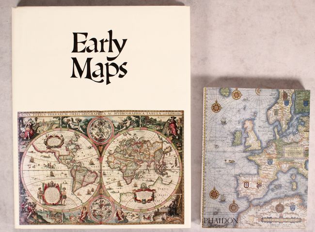
A. Early Maps, by Tony Campbell, published 1981 (12.2 x 15.3"). This reference book contains an array of early maps, municipal plans, and sea charts from the 13th century to the 1850s. Each plate is accompanied by information on the cartographer and an explanation of the political developments and geographical discoveries that influenced the map's design. Hardbound in green cloth with gilt letters on spine and illustrated original dust-wrapper. 148 pp., 68 color plates, several foldouts. Condition: Contents are clean and tight. Covers are slightly bumped. Dust jacket has minor soiling.
B. Antique Maps, by Carl Moreland and David Bannister, published 1993 (7.4 x 9.8"). This is the first paperback edition of this invaluable reference that covers map-making, cartographers, and collecting. The book lays out the history of map-making methods from the late 15th century onward. Brief biographies of the major map-makers are included. It also provides advice for the collector on the practical aspects of collecting and care. Illustrations in B&W (168) and color (8) in 326 pages, including bibliography and index. Illustrated paperback covers. Condition: Contents and covers tight, with minor soiling on the back cover.
References:
Condition: A
See description above.