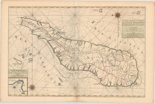
Subject: Madagascar
Period: 1700 (circa)
Publication:
Color: Hand Color
Size:
33.4 x 22.3 inches
84.8 x 56.6 cm
This stunning sea chart depicts Madagascar with its political divisions. Soundings and hazards are shown exclusively along the southern and western coasts. There is nice topographical detail inland, and several place names appear, mostly near the coastline. Fort Dauphin (present-day Tolonaro), the first French settlement on the island, is located. There is an inset at bottom left that zooms in on the Bay of Saint-Augustin. Several smaller islands surrounding Madagascar are identified throughout. North is oriented to the left by two spectacular compass roses. Three distance scales appear in the title cartouche. This chart likely appeared in either Atlas Suite de Neptune Francais or Atlas Nouveau Contenant les Parties du Monde.
References: Pastoureau, JAILLOT IF #356.
Condition: B+
A fine impression with light offsetting and some minor spots.