Subject: Holy Land
Period: 1684 (published)
Publication:
Color: Hand Color
Size:
22.1 x 17 inches
56.1 x 43.2 cm
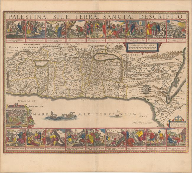
Jansson's map of the Holy Land is one of the most decorative published in the seventeenth century. The map is an adaptation of Adrichom's historical map. The coastline stretches from Sidon to Alexandria, but with a sharp bend between Palestine and Egypt instead of the straight coastline of Adrichom. The traditional Exodus route is prominent through the desert, and the Canaan is divided into the twelve ancient tribes. The Kishon River incorrectly connects the Mediterranean with the Sea of Galilee, and the southern tip of the Dead Sea has a westward bent. Eighteen historical illustrations form panels at top and bottom. Among the illustrations are the Pharaoh's daughter discovering Moses in a basket of reeds, God calling from the burning bush, the parting of the Red Sea, miracles performed in the desert, Moses' receiving the Tablets of the Law on Mr. Sinai, and the return of the scouts from the Promised Land. A small view of Jerusalem, with Jesus approaching on a donkey introduces a New Testament theme to this historical map. Blank verso.
References: Laor #372A; Nebenzahl (HL) #43; Van der Krogt (Vol. I) #8150:1B.
Condition: A
Minor toning along the centerfold with a couple of printer's creases adjacent to the centerfold.