Subject: Strait of Gibraltar
Period: 1797 (circa)
Publication: Recueil de Combats et d'Expeditions Maritimes
Color: Hand Color
Size:
12.6 x 8.1 inches
32 x 20.6 cm
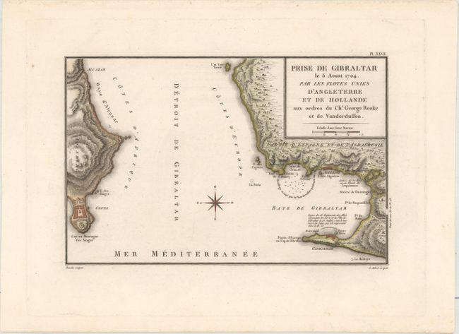
This map depicts the August 1704 siege of Gibraltar during the War of Spanish Succession. Britain and the Dutch Republic joined forces against France and Spain to capture Gibraltar, and thereby gain control of the Straits of Gibraltar. The allied fleet was commanded by British Admiral George Rooke Gibraltar and Dutch Rear Admiral Paulus van der Dussen and began with landing 2,000 marines on the isthmus to cut Gibraltar off from the rest of Spain. Rooke then ordered a squadron of vessels to form a line between Old Mole and New Mole and bombard Gibraltar's fortifications. The Allied encampments are depicted on the map adjacent to the fortifications, and the line of ships is illustrated as well. Another group of ships is shown across the bay. Engraved by Sebastien Francois Bouclet with lettering by L. Aubert. Published in Nicolas Ozanne's Recueil de Combats et d'Expeditions Maritimes...
References:
Condition: A
A dark impression on a clean, bright sheet.