Catalog Archive
Auction 174, Lot 624

"Die Sud Cust von Andalusien von Cadiz durch die Meer Enge Gibaltar oder die Strasse aus dem Oceano ins Mittellaendische Meer", Bodenehr, Gabriel

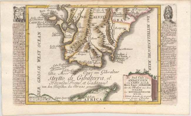
Subject: Strait of Gibraltar

Period: 1704 (published)

Publication: Atlas Curieux

Color: Hand Color

Size:
10.9 x 6.7 inches
27.7 x 17 cm
Download High Resolution Image
(or just click on image to launch the Zoom viewer)

Fine small map of the strategic Strait of Gibraltar. The map provides a detailed view of the Algecarias promontory in Andalusia, from Cadiz to Marbella, and the opposing coast of Africa from Tanger to Ceula. The map shows fortifications, anchorages, mountain ranges, towns and villages. Panels of text down each side of the engraving give a history of the region.

References:

Condition: A

A crisp impression with light toning along the edges of the sheet.

Estimate: $110 - $140

Sold for: $80

Closed on 9/11/2019

Archived