Subject: Mediterranean Islands
Period: 1534 (circa)
Publication: Isolario
Color: Black & White
Size:
8.3 x 12.1 inches
21.1 x 30.7 cm
This lot includes 21 disbound sheets from Benedetto Bordone's Isolario, featuring 49 maps of Mediterranean Islands. isolario (which translates as "book of islands"), was the first atlas covering the entire world based on contemporary information rather than classical geography. It included 112 simple and striking maps scattered through the text, depicting islands throughout the world, with a particular emphasis on islands in the Mediterranean Sea. Bordone first published his Isolario in 1528, with further editions in 1534, 1547, and 1565. The sheets in this lot are most likely from the 1534 edition, which had maps printed from the same blocks used in the 1528 edition, with reset text. This lot includes:
A. Liezena
B. Curzola
C. S. am de Tremidi
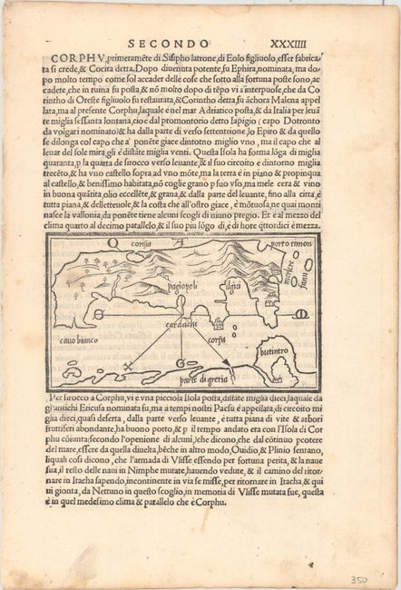
D. Corfu
E. Pacsu
F. S. Maura
G. Compare
H. Epiro Cuzolari Diluchio
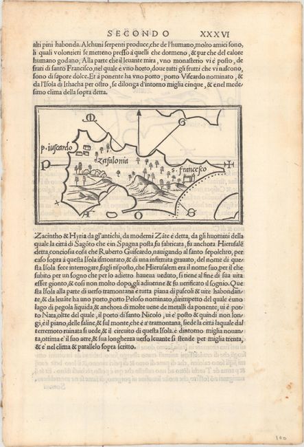
I. Zafalonia
J. Zante
K. Striuali
L. P. Della Morea
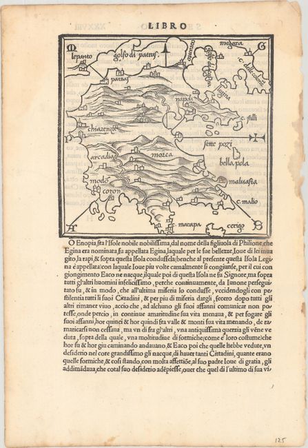
M. Morea
N. Sdile
O. Tino
P. Andre
Q. Zea
R. Fermene
S. Curzola
T. Siphano
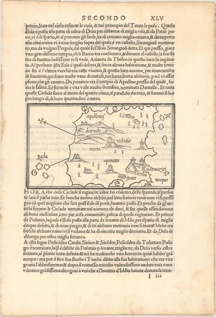
U. Milo
V. Nio
W. Amurgo
X. Antipario Pario
Y. Nixia
Z. Polimio Policandro Cardia Sicino
AA. Fecussa Scinussa Heraclia Chiero Pyra
BB. Charusa Zinara Leuita
CC. Micole
DD. Stapodia Nicaria Fornelli
EE. Palmosa
FF. Iero
GG. Calamo
HH.Stampalia
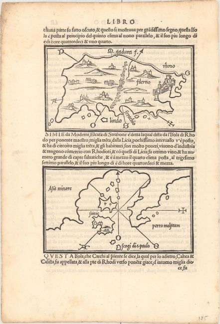
II. Rhodo
JJ. Simie
KK. Limonia Carchi
LL. Episcopia
MM. Lango
NN. Fornoli Mandria Lipso Crusia
OO. Tenedo Lembro
PP. Samotracia Lembro
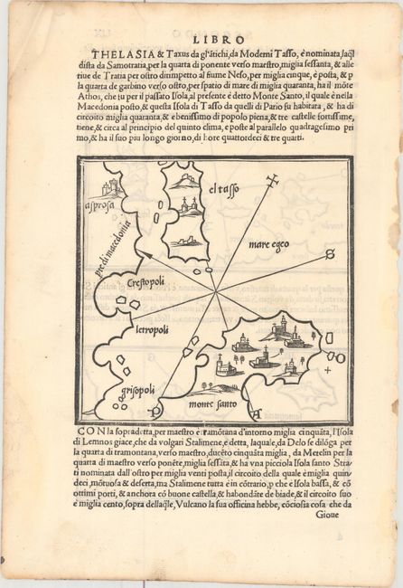
QQ. El Tasso Monte Santo
RR. Stalinmene S. Strati
SS. Limene Pelagisi Larsura la Iura
TT. Dromo Sarachino El Caloiero o Uer. S. Ilia
UU. Sciatos Scopelos
VV. Schiropola Sciro
WW. Taurica Chersoneso
References: Mickwitz & Miekkavaara #27; Shirley (BL Atlases) T-BORD-1a.
Condition: A
Bright sheets with light, scattered foxing that is mostly outside of the map images and a few minor manuscript notations.