Subject: Northern Italy
Period: 1741 (published)
Publication: Description Exacte de l'Univers
Color: Hand Color
Size:
17.8 x 13.4 inches
45.2 x 34 cm
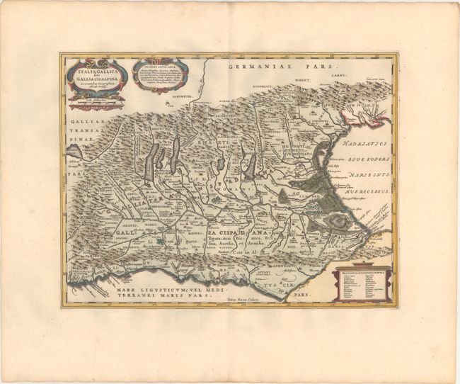
Handsome map of northern Italy showing the region during Roman times. The map was copied from Abraham Ortelius' map, which in turn was based on classical sources including Livius, Ausonius, Tacitus, Cato, Linius, Polybius and Cassidore. The Roman road, Aurelia via Antonino, is shown along the southern coast and into the important marble quarry district. Richly decorated with three cartouches and engraved by Pieter van den Keere (Petrus Kaerius). Blank verso, published in Pieter de Hondt's Description Exacte de l'Univers, ou l'Ancienne Geographie Sacree et Profane, a French edition of Georgius Hornius' Accuratissima Orbis Antiqui Delineatio, which included maps from Johannes Jansson's historical atlas and Abraham Ortelius' Parergon.
References: Van der Krogt (Vol. I) #7010H:1.
Condition: A+
A crisp impression on a clean, bright sheet with minor toning along the edges of the wide margins.