Subject: Southern Germany
Period: 1581 (published)
Publication: Theatrum Orbis Terrarum
Color: Hand Color
Size:
19.5 x 12.3 inches
49.5 x 31.2 cm
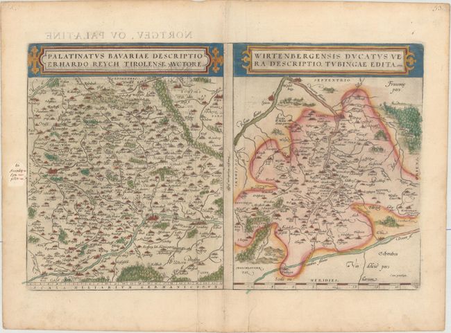
Two attractive maps on a folio sheet, each with their own strapwork cartouches, beautifully engraved by Frans Hogenberg. Both maps have charming pictorial depictions of cities and topography. Ortelius' map of Bayern (Bavariae) is based on the map by Erhart Reich. It is roughly centered on Amberg and extends to Nurnberg and Regensberg. The map of the Wurtemberg region (Wirtebergensis) is based on an anonymous map published in Tubingen in 1558. It is centered on Stuttgart and details the area between the Rhine and Danube rivers. Each map measures 9.5 x 12". French text on verso.
References: Van den Broecke #111.
Condition: A
A nice impression with some show-through of text on verso and professional repairs to a minor separation along the centerfold and to two tears in the bottom blank margin. A small piece of paper with an old manuscript annotation has been pasted in the left blank margin.