Subject: Central Europe, Germany
Period: 1711 (published)
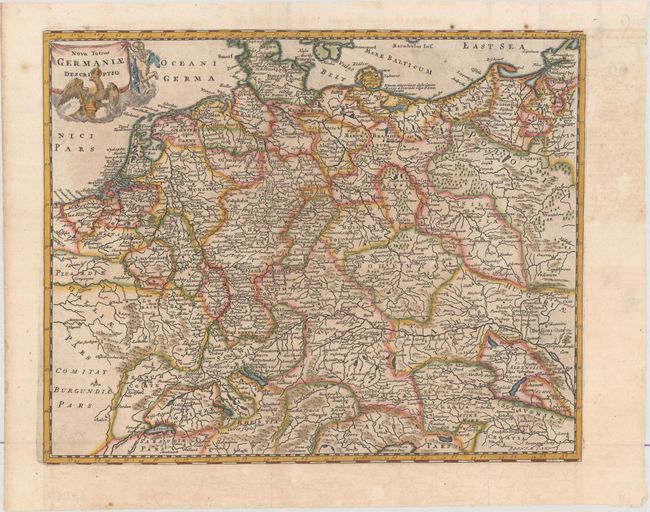
Publication: Introductio in Universam Geographicam
Color: Hand Color
Size:
12.8 x 10.3 inches
32.5 x 26.2 cm
Beautifully engraved map of Germany, Poland, Netherlands, Belgium, Switzerland and Austria. The decorative title cartouche features the imperial eagle of the German Empire and a putto.
Cluver's Introductio in Universam Geographicam was a popular atlas, appearing in over 45 editions during a 100-year period. The first edition was published without maps in the 1620s, and the first edition to include maps was published circa 1641. The various editions were published in different cities throughout Europe, including Amsterdam, Nuremberg, and London. This map is from a London edition, with the majority of the maps re-engraved by John Senex.
References: Shirley (BL Atlases) T.CLUV-9a #15.
Condition: A
Issued folding with minor toning and a few spots of foxing confined to the blank margins.